Contents
The pursuit of efficiency is part of our society and our zeitgeist. This affects almost all areas of life and definitely all areas of the professional world. Marketing is not exempt from this and so here, too, we strive for sensible solutions with the greatest possible positive effects.
“Targeting” plays an important role in this and does not only concern the selection of the sector or industry to be addressed, but of course also the region or city. If efforts are invested in the wrong place, this leads to a loss of resources and a reduction in effectiveness.
Address databases are an important basis for marketing activities in order to reach new customers or potential business partners, but incorrect address details would be a disaster at this point and have far-reaching negative consequences.
Incorrect and incomplete information in address databases is a known evil, but there is a professional remedy … “Geonormalisation”.
Geonormalisation, what is it?
Databases thrive on up-to-date, complete data records. Only verified and therefore high-quality data can ultimately fulfill its purpose, regardless of the application.
Address databases are an excellent example, and not just for email marketing.
Database normalization is a fundamental concept in itself, but adding geographical elements to it creates helpful synergies by linking information and space or location. The potential benefits increase significantly … assuming the data is complete and accurate.
This is where geonormalisation comes in, the process of organizing and standardizing geographical data to make it easily usable and consistent within a database or application. In the case of Bancomail and its high-value databases for marketing, this process is essential to ensure that geographic location information is standardized, completely accurate and easy to process.
The Bancomail Geonormalisation Model
Since off-the-shelf geonormalization solutions were either unavailable or not suitable for the specific needs of marketing databases, we made the decision to develop our own proprietary method in 2002.
This method was designed to address the unique challenges of handling large volumes of address data and to ensure the highest levels of accuracy and consistency.
Over the years, we have continuously refined and updated our method, drawing on the expertise of our internal team and collaborating with community experts. This collaborative approach has allowed us to stay at the forefront of geonormalization technology and to provide our customers with the best possible experience.
Geonormalisation and … tables!?
We are talking about databases and part of these databases are numerous tables. These tables ultimately contain the data, whereby one table contains all related data, for example a table for names, a table for e-mail addresses or a table for telephone numbers, and so on.
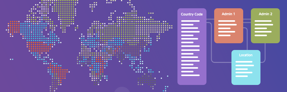
Which tables are actually involved in Geonormalisation?
- Table of ISO 3166 country codes This table contains a list of two-letter codes that identify all countries in the world according to the ISO 3166 standard. Each country is assigned a unique code that simplifies the identification and geolocalisation of data relating to a specific country.
- Table of First-level administrations (Regions) This table contains information about regions or the first level of administration within a country. The regions are often used as the main administrative units and are essential for the organization of data at the geographical level.
- Table of Second-level administrations (Provinces) In some countries, regions are further subdivided into provinces or second-level administrative units. This table provides details of these subdivisions and helps to identify more precise locations within a region.
- Table of Localities This table contains information about specific localities, such as cities, towns or other settlements. It is the most detailed table and provides specific data on geographical locations within provinces or regions.
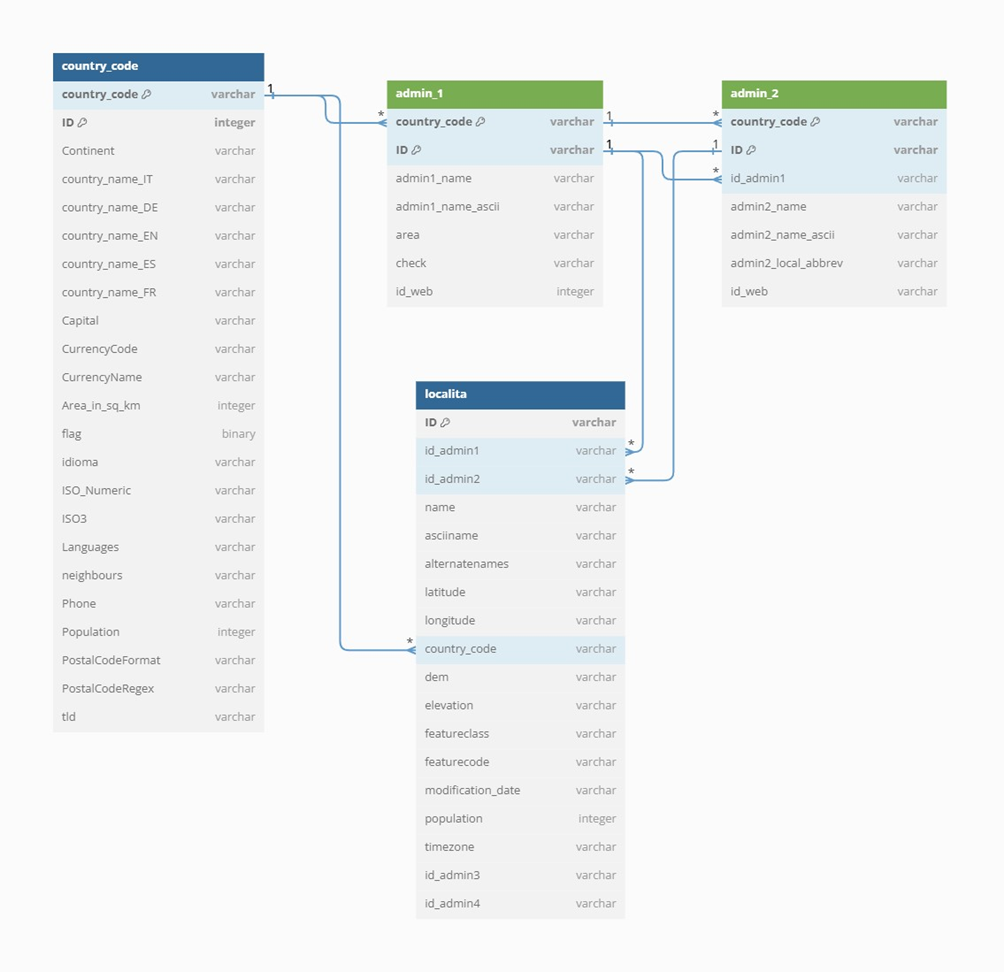
Relations between the tables
The geographical tables in Bancomail are linked to each other via primary and foreign keys. For example, the Localities table can be linked to the Provinces table using the province code as a foreign key. These relationships make it possible to link the geographical information between the different tables and to determine detailed data about the location of a company or person within a specific region or province.
Conclusion
In summary, geonormalisation at Bancomail is a key process to ensure the consistency and accuracy of geographic data. The four main tables and the relations between them enable the efficient organization and management of geographic location information, simplifying data access and analysis with our databases for your business and marketing purposes and ultimately successful results.